St. Paul Island, Alaska
ca. 1885 - ca. 1889
Add to Favorites:
Add all page(s) of this document to activity:
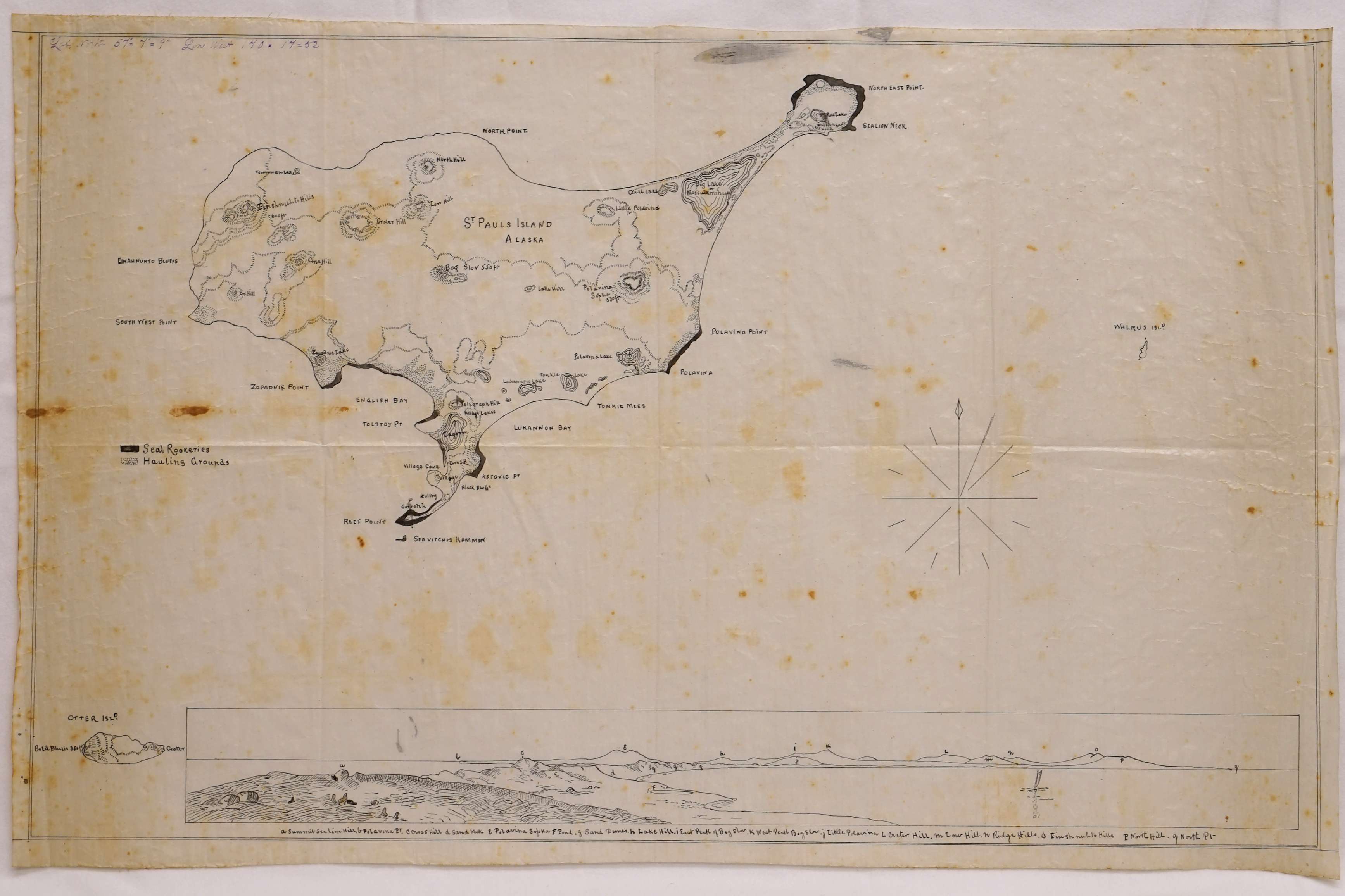
This map comes from a series of photographs, charts, and plans compiled by Abial P. Loud, special treasury agent in the Pribilof Islands (Alaska) from 1885 to 1889. It shows topographical features such as hills. lakes, points, ponds, and sand dunes. Seal rookeries and hauling grounds are also marked.
This primary source comes from the General Records of the Department of the Treasury.
National Archives Identifier: 23869062
Full Citation: St. Paul Island; ca. 1885 - ca. 1889; Photographs and Charts of Treasury Agent Abial P. Loud, ca. 1885 - ca. 1889; General Records of the Department of the Treasury, Record Group 56; National Archives at Seattle, Seattle, WA. [Online Version, https://docsteach.org/documents/document/stpaul-island-alaska, April 27, 2024]Rights: Public Domain, Free of Known Copyright Restrictions. Learn more on our privacy and legal page.
