Map showing the location of Military Posts, Indian Reservations and Principal Routes
1872
Add to Favorites:
Add all page(s) of this document to activity:
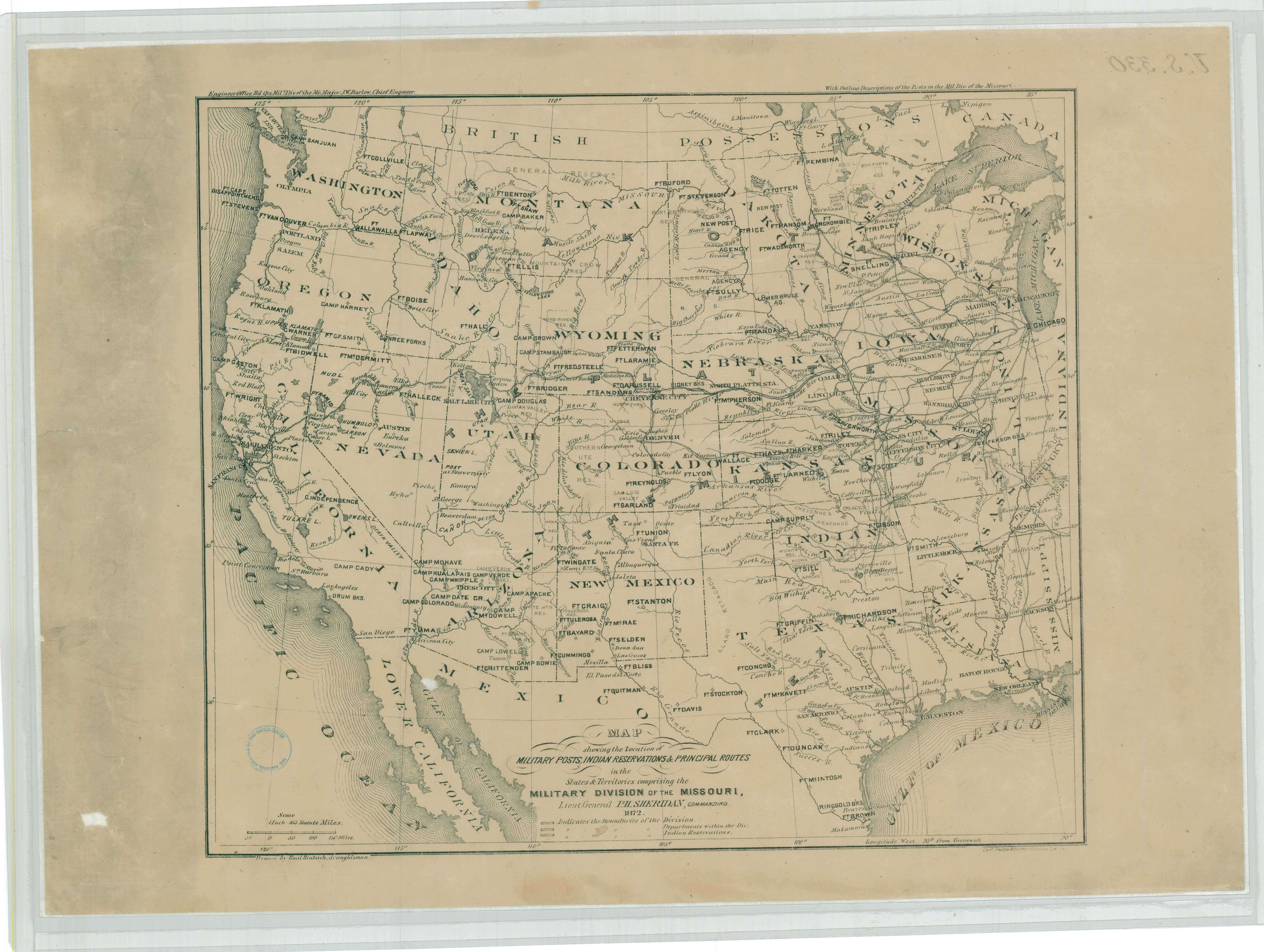
This map depicts the location of various U.S. Army posts, American Indian reservations, and principal routes of the states and territories within the Military Division of the Missouri, which was first established in 1865.
The Military Division of the Missouri varied in size throughout its history, but in 1872, when the map was created, it generally included the states Illinois, Iowa, Kansas, Minnesota, Missouri, Nebraska, and Texas; and the territories Colorado, Montana, New Mexico, Utah, Wyoming, Indian Territory, and the Dakota Territory.
In addition, the nation's first Transcontinental Railroad passed through the Military Division of the Missouri as it connected the Atlantic coast to the Pacific coast by rail.
This primary source comes from the Records of the Office of the Chief of Engineers.
National Archives Identifier: 100306041
Full Citation: Map showing the location of Military Posts, Indian Reservations and Principal Routes in the States and Territories Comprising the Military Division of the Missouri; 1872; United States; Civil Works Map File, 1818 - 1947; Records of the Office of the Chief of Engineers, Record Group 77; National Archives at College Park, College Park, MD. [Online Version, https://docsteach.org/documents/document/map-showing-location-military-posts-indian-reservations-and-principal-routes, April 26, 2024]Rights: Public Domain, Free of Known Copyright Restrictions. Learn more on our privacy and legal page.
