Map of the United States Showing the Acquisition of National and Public Domain West of the Mississippi
1853
Add to Favorites:
Add all page(s) of this document to activity:
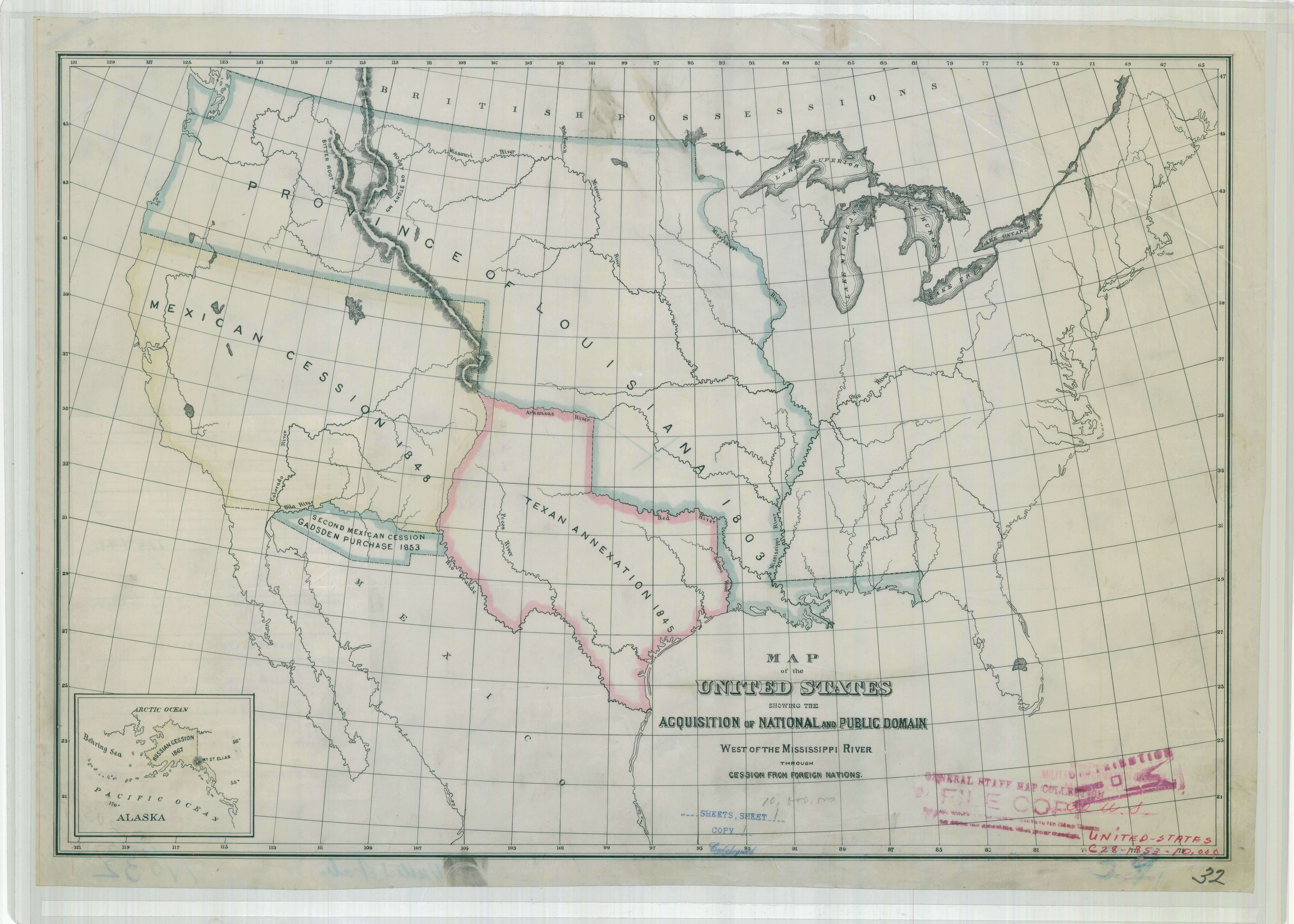
This primary source comes from the Records of the Office of the Chief of Engineers.
National Archives Identifier: 77452221
Full Citation: Map of the United States Showing the Acquisition of National and Public Domain West of the Mississippi River through Cession from Foreign Nations; 1853; United States; War Department Map Collection, 1939 - 1942; Records of the Office of the Chief of Engineers, Record Group 77; National Archives at College Park, College Park, MD. [Online Version, https://docsteach.org/documents/document/map-of-the-united-states-showing-the-acquisition-of-land, April 26, 2024]Rights: Public Domain, Free of Known Copyright Restrictions. Learn more on our privacy and legal page.
