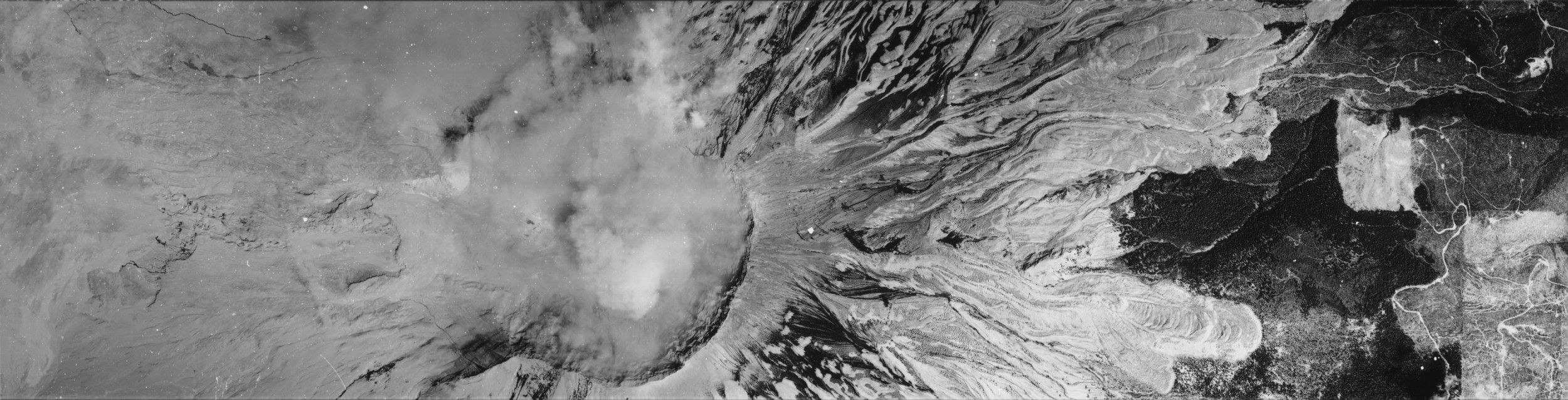
Aerial Photograph of Mount Saint Helens, Washington
7/22/1980
Add to Favorites:
Add all page(s) of this document to activity:
Additional details from our exhibits and publications
On May 18, 1980, a 5.1 magnitude earthquake triggered an eruption of Mount St. Helens in Washington state. This aerial photograph, taken on July 22, 1980, show the volcano’s collapsed north face and shortened peak, with smoke still rising from the crater.
This primary source comes from the Records of the Central Intelligence Agency.
National Archives Identifier: 595259
Full Citation: Aerial Photograph of Mount Saint Helens, Washington; 7/22/1980; Records of the Central Intelligence Agency, Record Group 263. [Online Version, https://docsteach.org/documents/document/aerial-photograph-of-mount-saint-helens-washington, April 26, 2024]Rights: Public Domain, Free of Known Copyright Restrictions. Learn more on our privacy and legal page.
