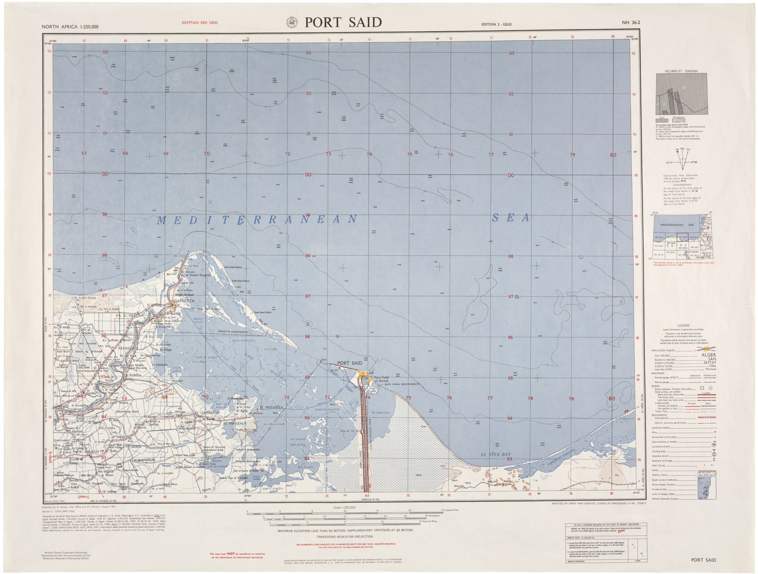
Map of Port Said, Egypt
8/1956
Add to Favorites:
Add all page(s) of this document to activity:
Additional details from our exhibits and publications
This is an August 1956 map of Port Said, Egypt, one of the thousands of maps created by the Department of Defense. They cover most of the world’s land masses, at various scales, and include features like elevation, roads and railroads, cities and towns, and bodies of water. The Suez Canal is in the lower center of this map
This primary source comes from the Records of the Office of the Chief of Engineers.
National Archives Identifier: 596269
Full Citation: Map of Port Said, Egypt; 8/1956; Records of the Office of the Chief of Engineers, Record Group 77. [Online Version, https://docsteach.org/documents/document/map-of-port-said-egypt, April 29, 2024]Rights: Public Domain, Free of Known Copyright Restrictions. Learn more on our privacy and legal page.
