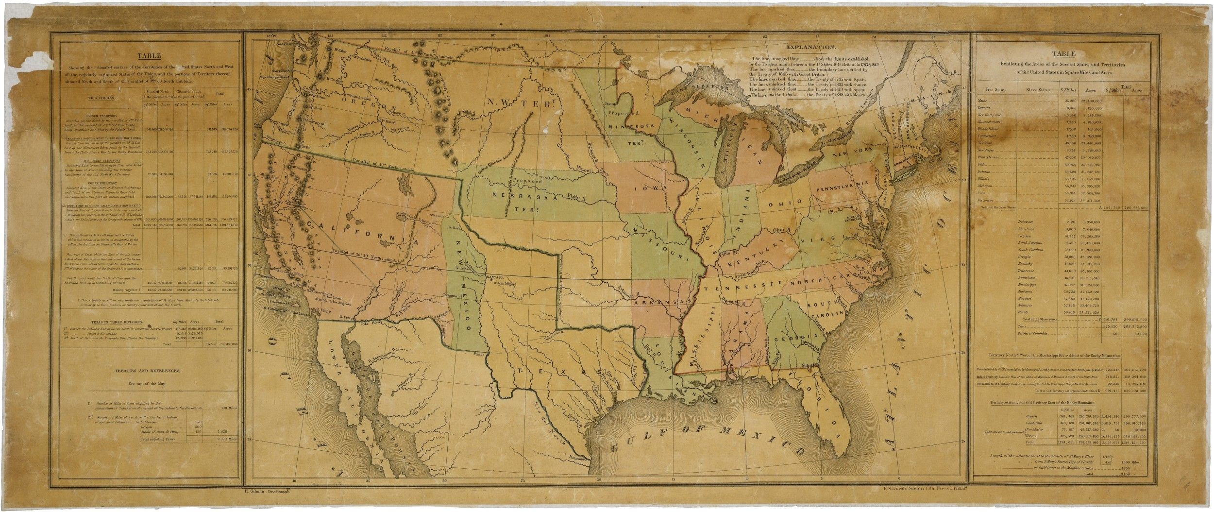
Map of the United States Including Western Territories
12/1848
Add to Favorites:
Add all page(s) of this document to activity:

This map was ordered by President James K. Polk to accompany his annual message to Congress in December 1848. Principal draftsman Ephraim Gilman, of the U.S. General Land Office, created the map to show all of the existing states, territories, proposed territories, and the area of the Mexican Cession in the southwest acquired by the terms of the Treaty of Guadalupe Hidalgo, which ended the war with Mexico.
It represents Polk's conception, as a Southern Democrat, of how to divide up the new territory acquired through the Treaty. It became the starting point of debates in Congress over slavery and westward expansion.
It represents Polk's conception, as a Southern Democrat, of how to divide up the new territory acquired through the Treaty. It became the starting point of debates in Congress over slavery and westward expansion.
This primary source comes from the Records of the U.S. House of Representatives.
National Archives Identifier: 2127339
Full Citation: Map of the United States Including Western Territories; 12/1848; (HR29A-B1); General Records, 1791 - 2010; Records of the U.S. House of Representatives, Record Group 233; National Archives Building, Washington, DC. [Online Version, https://docsteach.org/documents/document/western-territories-map, April 19, 2024]Rights: Public Domain, Free of Known Copyright Restrictions. Learn more on our privacy and legal page.


