Map of the USS Maddox Incident
7/30/1964-8/2/1964
Add to Favorites:
Add all page(s) of this document to activity:
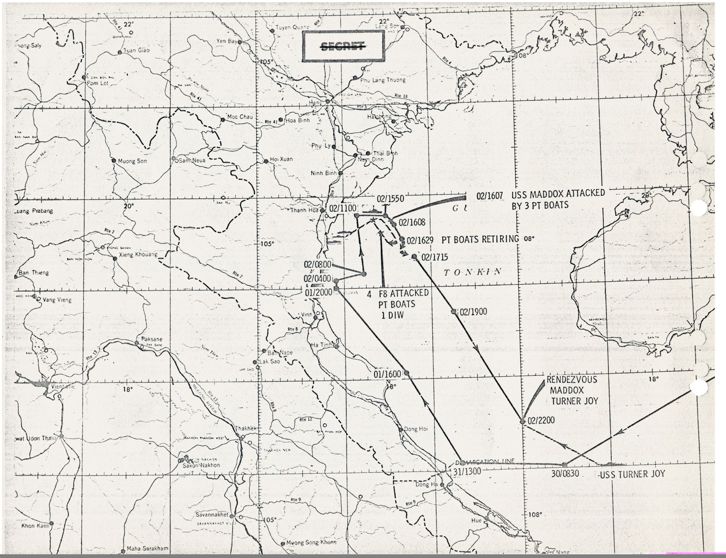
This chart depicts the patrol route of the USS Maddox and the USS C. Turner Joy from July 30 to August 2, 1964. The Maddox sailed into the Gulf of Tonkin, off the North Vietnamese coast on July 31. The ship’s path is shown as a black line with dots representing her location on a date and time (expressed in 24-hour increments).
A notation on the chart notes the Maddox was attacked on August 2 by three North Vietnamese torpedo boats at 4:07 p.m. Note that four American F-8 aircraft attacked the boats, destroying one in the water.
A notation on the chart notes the Maddox was attacked on August 2 by three North Vietnamese torpedo boats at 4:07 p.m. Note that four American F-8 aircraft attacked the boats, destroying one in the water.
This primary source comes from the Collection LBJ-NSF: National Security Files.
National Archives Identifier: 593268
Full Citation: Map 132; Map of the USS Maddox Incident; 7/30/1964-8/2/1964; Maddox Incident 8/4/64; Operation Pierce Arrow 8/5/64; Vietnam Country Files, 11/22/1963 - 1/20/1969; Collection LBJ-NSF: National Security Files; Lyndon Baines Johnson Library, Austin, TX. [Online Version, https://docsteach.org/documents/document/map-maddox-incident, May 2, 2024]Rights: Public Domain, Free of Known Copyright Restrictions. Learn more on our privacy and legal page.