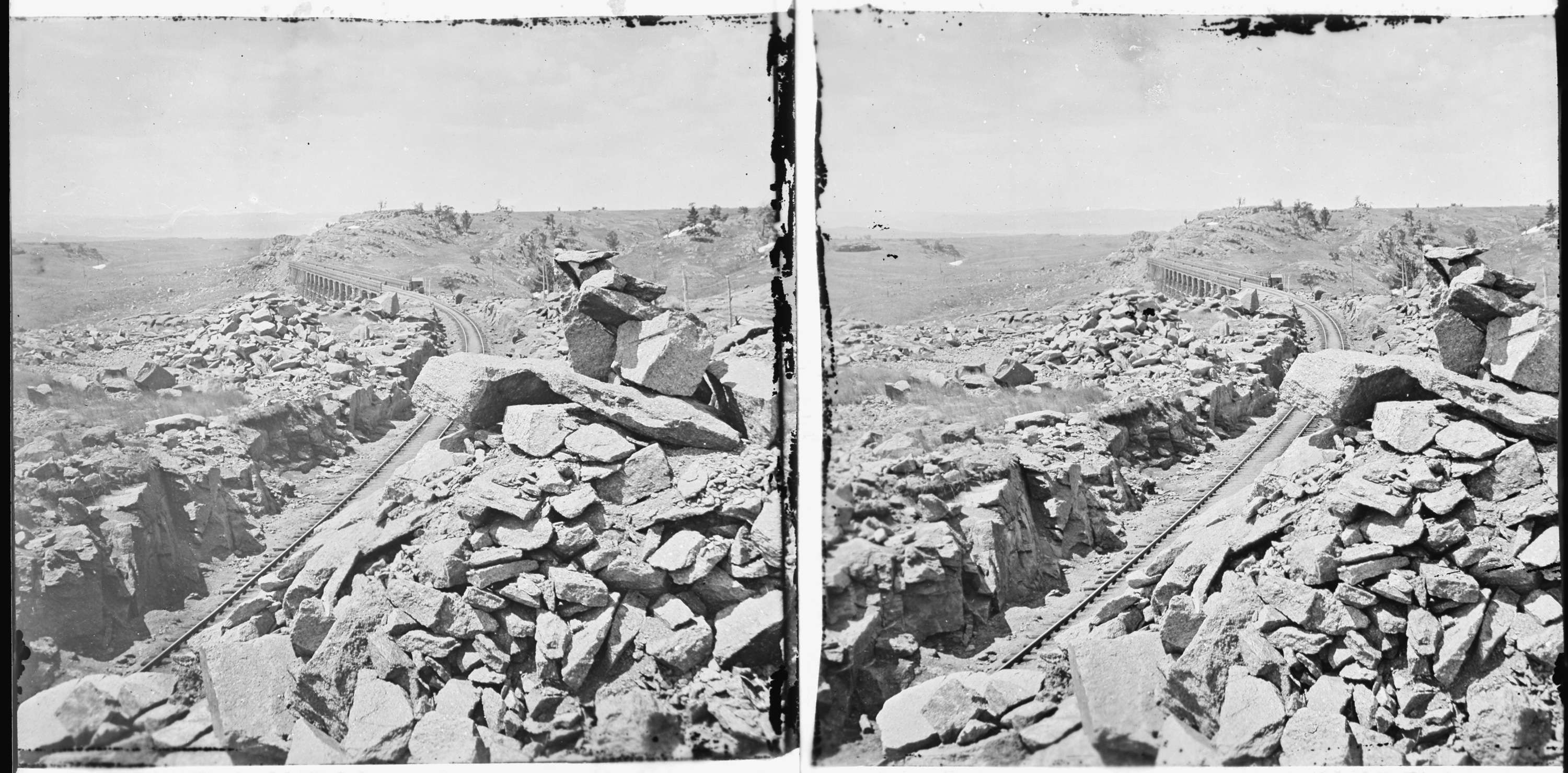
Dale Creek Bridge, West of Cheyenne, Wyoming
1869
Add to Favorites:
Add all page(s) of this document to activity:

In the second half of the 19th century, the U.S. Government sponsored four major expeditions to explore and map the regions west of the Mississippi River. One of these, known as the Hayden Survey because it was led by Ferdinand Vandeveer Hayden, first explored the area around Yellowstone in Wyoming and later Colorado. This survey was also known as the "U.S. Geological and Geographical Survey of the Territories" and lasted from 1867 to 1879.
Photographer William Henry Jackson and artists Thomas Moran and Henry Wood Elliot accompanied the survey to document the scenes for those back east. Jackson took this photograph near Cheyenne, Wyoming. The Hayden Survey's illustrated report on its 1871 studies in Yellowstone influenced Congress to establish that area as the first national park.
Photographer William Henry Jackson and artists Thomas Moran and Henry Wood Elliot accompanied the survey to document the scenes for those back east. Jackson took this photograph near Cheyenne, Wyoming. The Hayden Survey's illustrated report on its 1871 studies in Yellowstone influenced Congress to establish that area as the first national park.
This primary source comes from the Records of the U.S. Geological Survey.
National Archives Identifier: 517377
Full Citation: Photograph 57-HS-841; Dale Creek Bridge, West of Cheyenne, Wyoming; 1869; Hayden Survey, William H. Jackson, Photographs, 1869 - 1878; Records of the U.S. Geological Survey, Record Group 57; National Archives at College Park, College Park, MD. [Online Version, https://docsteach.org/documents/document/dale-creek-bridge, May 3, 2024]Rights: Public Domain, Free of Known Copyright Restrictions. Learn more on our privacy and legal page.
