Map of the lands included in Central Park from a Topographical Survey
1856
Add to Favorites:
Add all page(s) of this document to activity:
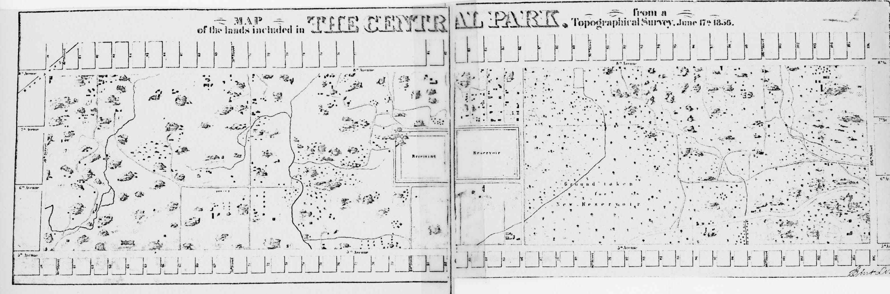
Central Park was the first large-scale public park in the United States that was designed and constructed according to a plan. Designed by Frederick Law Olmsted and Calvert Vaux, the 843 acre park is located in the middle of Manhattan in New York City.
This map and description of the Central Park in New York City, NY are part of materials from its Nomination form for the National Register of Historic Places.
This map and description of the Central Park in New York City, NY are part of materials from its Nomination form for the National Register of Historic Places.
This primary source comes from the Records of the National Park Service.
National Archives Identifier: 75315940
Full Citation: Map of the lands included in Central Park from a Topographical Survey; 1856; National Register of Historic Places and National Historic Landmarks Program Records: New York; National Register of Historic Places and National Historic Landmarks Program Records, 2013 - 2017; Records of the National Park Service, Record Group 79; National Archives at College Park, College Park, MD. [Online Version, https://docsteach.org/documents/document/central-park-topographical-survey, April 28, 2024]Rights: Public Domain, Free of Known Copyright Restrictions. Learn more on our privacy and legal page.