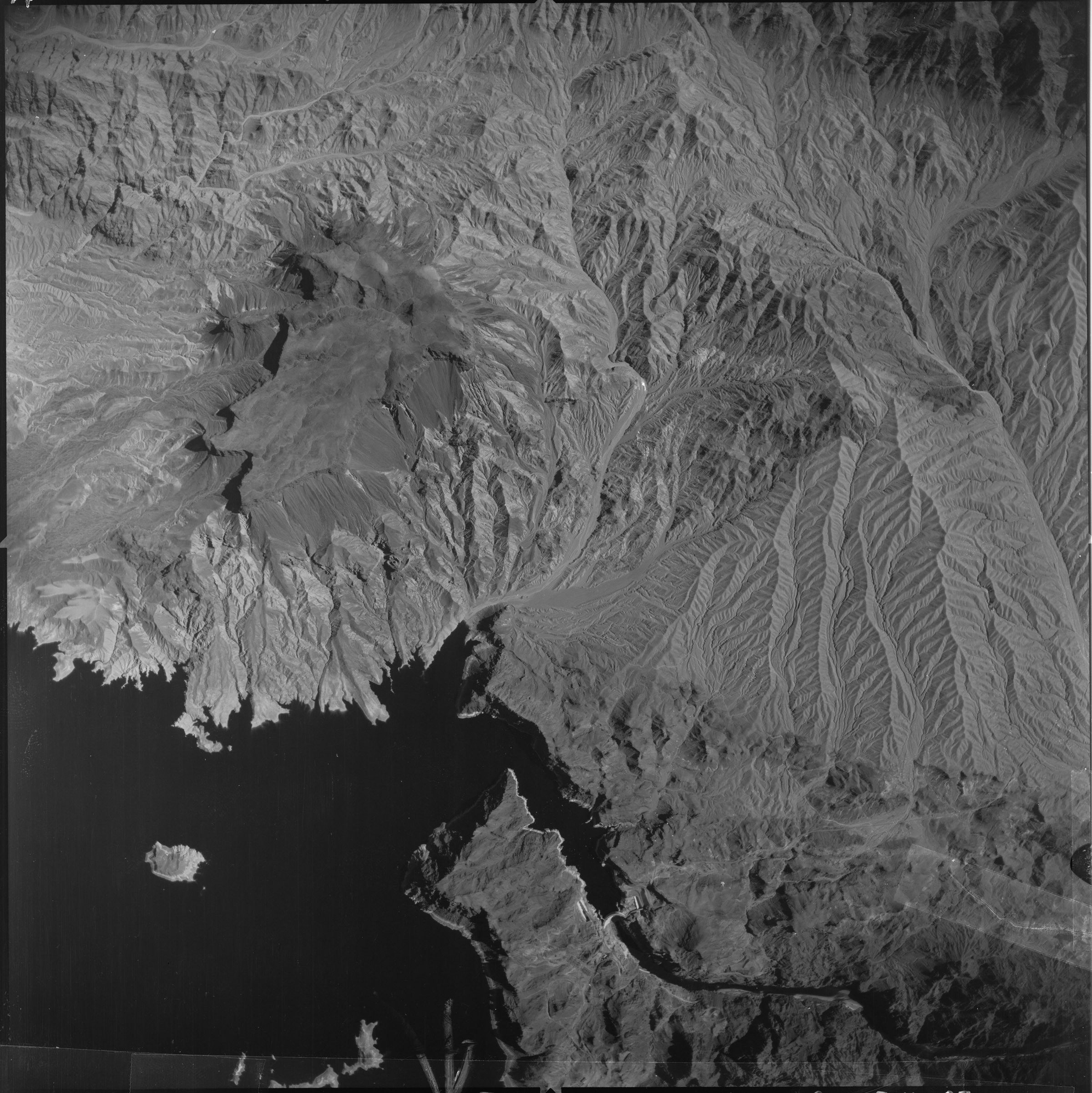
Aerial Photograph of the Hoover Dam on the Border of Nevada and Arizona
10/30/1955
Add to Favorites:
Add all page(s) of this document to activity:
Additional details from our exhibits and publications
Near the bottom of this aerial photograph, taken on October 30, 1955, is the Hoover Dam, which spans the Colorado River along the Nevada-Arizona border. The concrete arch-gravity dam brought water and power to arid regions of the American southwest and was considered a great engineering feat upon its dedication in 1935. Originally called Boulder Dam, it was renamed in 1947 for President Herbert Hoover, who was involved in its planning and construction while serving as Secretary of Commerce and later as President.
This primary source comes from the Records of the Defense Intelligence Agency.
National Archives Identifier: 595093
Full Citation: Aerial Photograph of the Hoover Dam on the Border of Nevada and Arizona; 10/30/1955; Records of the Defense Intelligence Agency, Record Group 373. [Online Version, https://docsteach.org/documents/document/aerial-photograph-of-the-hoover-dam-on-the-border-of-nevada-and-arizona, April 23, 2024]Rights: Public Domain, Free of Known Copyright Restrictions. Learn more on our privacy and legal page.
