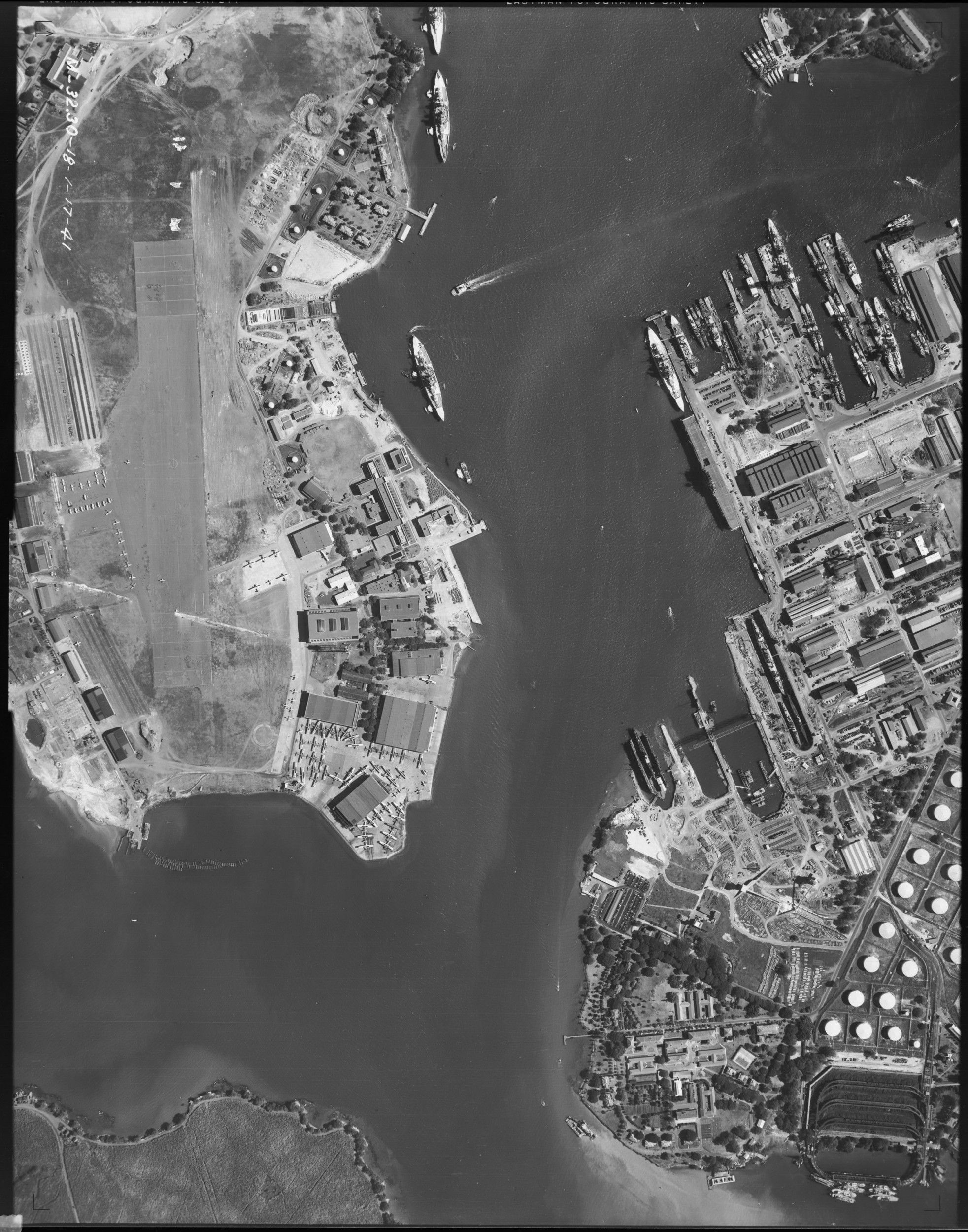
Aerial Photograph of Pearl Harbor, Hawaii
1/17/1941
Add to Favorites:
Add all page(s) of this document to activity:
Additional details from our exhibits and publications
This aerial photograph shows the naval base at Pearl Harbor on Oahu, Hawaii (then the Territory of Hawaii), on January 17, 1941. The U.S. Navy was in the process of expanding Pearl Harbor to serve as home port for its Pacific Fleet when this photograph was taken. Just 11 months later on December 7, Japanese forces attacked here, driving the United States into World War II. Hard hit in the attack were the ships anchored along “Battleship Row” on Ford Island, which can be seen in the upper left portion of the photograph.
This primary source comes from the Records of the Defense Intelligence Agency.
National Archives Identifier: 595097
Full Citation: Aerial Photograph of Pearl Harbor, Hawaii; 1/17/1941; Records of the Defense Intelligence Agency, Record Group 373. [Online Version, https://docsteach.org/documents/document/aerial-photograph-of-pearl-harbor-hawaii, April 25, 2024]Rights: Public Domain, Free of Known Copyright Restrictions. Learn more on our privacy and legal page.
