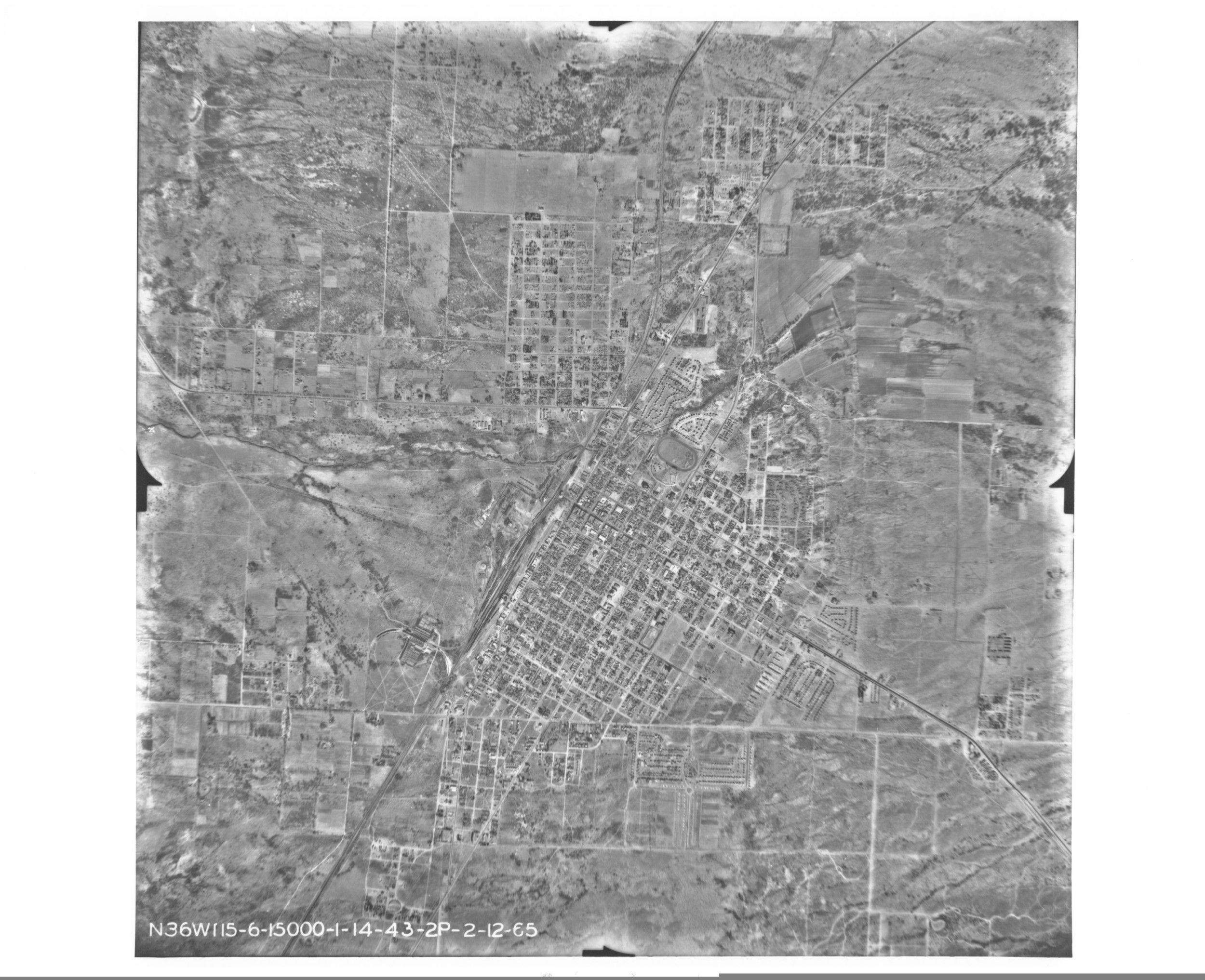
Aerial Photograph of Las Vegas, Nevada
1943
Add to Favorites:
Add all page(s) of this document to activity:
Additional details from our exhibits and publications
When this aerial photograph was taken in 1943, Las Vegas, Nevada, was undergoing dramatic change. After the completion of the nearby Hoover Dam and the legalization of gambling in the 1930s, population and development grew rapidly in the city. Las Vegas Boulevard, including the famous section nicknamed “the Strip,” can be seen just to the right of the ellipse near the middle of the photograph.
This primary source comes from the Records of the Defense Intelligence Agency.
National Archives Identifier: 595092
Full Citation: Aerial Photograph of Las Vegas, Nevada; 1943; Records of the Defense Intelligence Agency, Record Group 373. [Online Version, https://docsteach.org/documents/document/aerial-photograph-of-las-vegas-nevada, April 25, 2024]Rights: Public Domain, Free of Known Copyright Restrictions. Learn more on our privacy and legal page.
