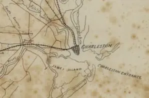
This map shows rivers, towns, roads, and railroads. It was made to accompany a report by Captain R. H. Barnwell, engineer, on the best locations for troops to protect the South Carolina Railroad.
It comes from a series of maps created by the Confederate States of America that were acquired by the U.S. War Department by capture or surrender during the Civil War, or by donation or purchase after the War.


