
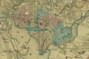
Topographical Map of the Original District of Columbia and Environs Showing the Fortifications around the City of Washington
- 1862
Share to Google Classroom
View the full document here: https://docsteach.org/document/topographical-map-of-the-original-district-of-columbia-and-environs-showing-the-fortifications-around-the-city-of-washington/
Citation
This primary source comes from the Records of the Office of the Chief of Engineers.
National Archives Identifier: 31491213
Full Citation: Topographical Map of the Original District of Columbia and Environs Showing the Fortifications around the City of Washington; 1862; Maryland, the District of Columbia, and the Potomac River; Civil Works Map File, 1818 – 1947; Records of the Office of the Chief of Engineers, Record Group 77; National Archives at College Park, College Park, MD. [Online Version, https://docsteach.org/document/topographical-map-of-the-original-district-of-columbia-and-environs-showing-the-fortifications-around-the-city-of-washington/, June 30, 2026]
Rights: Public Domain, Free of Known Copyright Restrictions. Learn more on our privacy and legal page.
Related Documents

Ku Klux Klan Act of 1871
Civil War and Reconstruction (1850-1877)

Correspondence Relating to the Employment of Sarah Ann Degan
Civil War and Reconstruction (1850-1877)
