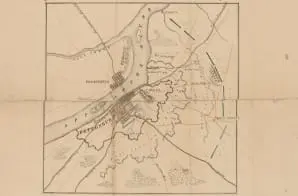
This Confederate map shows river, vegetation, topography, towns, roads, railroads, fortifications, and troop positions. It is one of several maps created by the Confederate States of America that were acquired by the U.S. War Department by capture or surrender during the Civil War, or by donation or purchase after the War. A note on the map says it was drawn by Lieut. Duvall of Florida and presented by Capt. M. B. Porteaux on August 25, 1874.


