
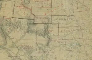
Map of the States and Their Territories Between the Mississippi River and the Pacific Ocean
- 1858
Share to Google Classroom
View the full document here: https://docsteach.org/document/map-states-and-territories-between-mississippi-river-and-pacific-ocean/
Citation
This primary source comes from the Records of the Office of the Chief of Engineers.
National Archives Identifier: 86744360
Full Citation: Map of the States and Their Territories Between the Mississippi River and the Pacific Ocean and Part of Mexico; 1858; United States; Civil Works Map File, 1818 – 1947; Records of the Office of the Chief of Engineers, Record Group 77; National Archives at College Park, College Park, MD. [Online Version, https://docsteach.org/document/map-states-and-territories-between-mississippi-river-and-pacific-ocean/, March 31, 2026]
Rights: Public Domain, Free of Known Copyright Restrictions. Learn more on our privacy and legal page.
Related Documents

Ku Klux Klan Act of 1871
Civil War and Reconstruction (1850-1877)

Correspondence Relating to the Employment of Sarah Ann Degan
Civil War and Reconstruction (1850-1877)
