Disturnell’s New Map of the United States and Canada Showing all the Canals, Railroads, Telegraph Lines, and Principal Stage Roads
Survey of St. John River and British Settlements of New Brunswick
Expansion and Reform (1801-1861)
A National Archives Foundation educational resource using primary sources from the National Archives

View the full document here: https://docsteach.org/document/map-of-united-states-and-canada-canals-railroads-telegraph-roads/
Disturnell’s New Map of the United States and Canada Showing all the Canals, Railroads, Telegraph Lines, and Principal Stage Roads
This primary source comes from the Records of the National Archives and Records Administration.
National Archives Identifier: 31491052
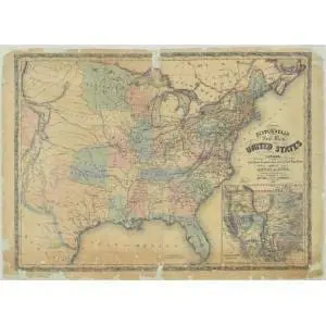
Full Citation: Disturnell’s New Map of the United States and Canada Showing all the Canals, Railroads, Telegraph Lines, and Principal Stage Roads; 01/01/1851; Reference Maps and Drawings, 1934 – 1989; Records of the National Archives and Records Administration, Record Group 64; National Archives at College Park, College Park, MD. [Online Version, https://docsteach.org/document/map-of-united-states-and-canada-canals-railroads-telegraph-roads/, February 2, 2026]
Rights: Public Domain, Free of Known Copyright Restrictions. Learn more on our privacy and legal page.