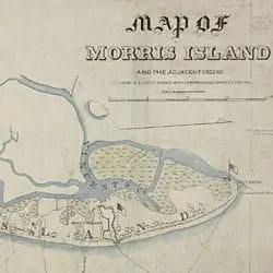
This 1863 map of Morris Island, South Carolina, shows why taking Fort Wagner was so difficult. It is located three-quarters of the way up the island when approached from the southwest, as the Union forces did. Moreover, it stretches across nearly the entire width of the island. Assaulting troops could not bypass the strongpoint and had to conduct a frontal attack.


