
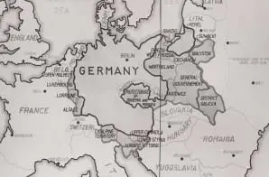
Map of Germany's expansion during WWII
- ca. 1946-1949
Share to Google Classroom
View the full document here: https://docsteach.org/document/map-of-germanys-expansion-during-wwii/
Citation
This primary source comes from the National Archives Collection of World War II War Crimes Records.
National Archives Identifier: 169157881
Full Citation: 238-OMT-XII-E-1; Map of Germany’s expansion during WWII; ca. 1946-1949; Tribunal XII [12] – High Command Trial – Evidence; Photographs Relating to the Minor Nuremberg Trials, 1946 – 1949; National Archives Collection of World War II War Crimes Records, Record Group 238; National Archives at College Park, College Park, MD. [Online Version, https://docsteach.org/document/map-of-germanys-expansion-during-wwii/, April 22, 2026]
Rights: Public Domain, Free of Known Copyright Restrictions. Learn more on our privacy and legal page.
Related Documents


Japanese Internee Card for Fred Toyosaburo Korematsu
The Great Depression and World War II (1929-1945)

Postman Delivering Mail on a Rural Mail Route
The Great Depression and World War II (1929-1945)