
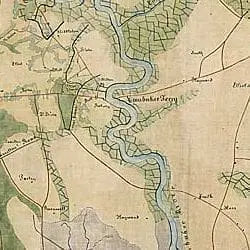
Map of a part of Beaufort and Colleton Districts between Broad River and South Edisto River
- ca. 1860 - 1865
Share to Google Classroom
View the full document here: https://docsteach.org/document/map-of-a-part-of-beaufort-and-colleton-districts-between-broad-river-and-south-edisto-river/
Citation
This primary source comes from the Records of the Office of the Chief of Engineers.
National Archives Identifier: 305621
Full Citation: Map of a part of Beaufort and Colleton Districts between Broad River and South Edisto River; ca. 1860 – 1865; Records of the Office of the Chief of Engineers, Record Group 77. [Online Version, https://docsteach.org/document/map-of-a-part-of-beaufort-and-colleton-districts-between-broad-river-and-south-edisto-river/, April 5, 2026]
Rights: Public Domain, Free of Known Copyright Restrictions. Learn more on our privacy and legal page.
Related Documents

Ku Klux Klan Act of 1871
Civil War and Reconstruction (1850-1877)

Correspondence Relating to the Employment of Sarah Ann Degan
Civil War and Reconstruction (1850-1877)
