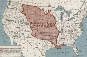
This map of the United States highlights in red the territory included in the Louisiana Purchase. Bought from France in 1803, the 820,000 square miles would eventually be split among the 16 states whose borders are outlined in black. The map was created for the centennial of the Louisiana Purchase in 1903.


