Early methods for allocating unsettled land outside the original 13 colonies were arbitrary and chaotic. Boundaries were established by stepping off plots from geographical landmarks. As a result, overlapping claims and border disputes were common.
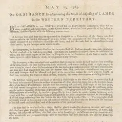
The Land Ordinance of 1785 finally implemented a standardized system of Federal land surveys that eased boundary conflicts. The official Government description of land was by range, township, and section. Using astronomical starting points, territory was divided into a 6-mile square called a township prior to settlement. The township was divided into 36 sections, each measuring 1 square mile or 640 acres each.
The Government instituted direct sales to purchasers by the Government. Sale of public land was a means to generate revenue for the Government; but it also encouraged settlement and helped to propel the nation westward.


")
")