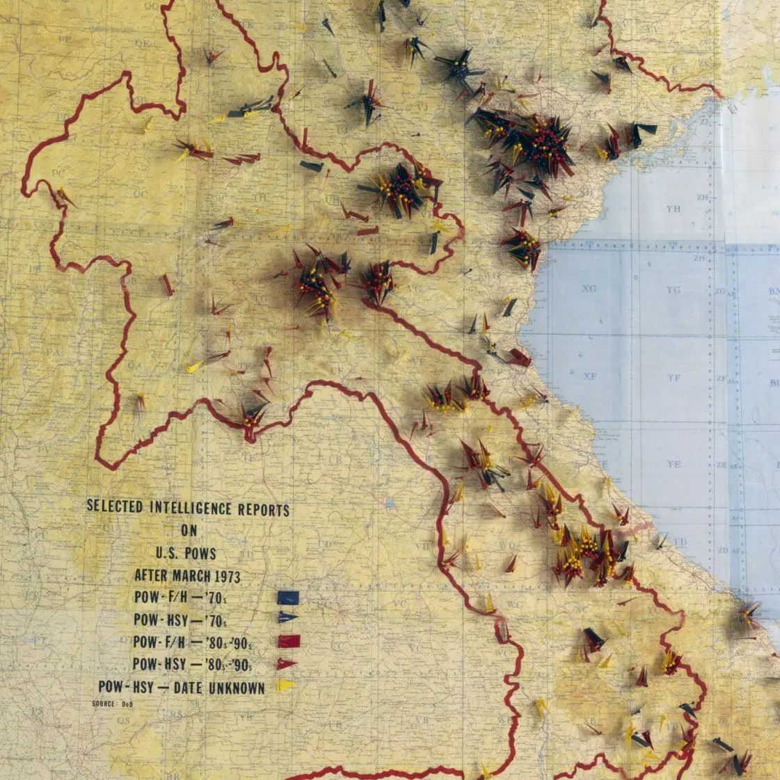
This map was compiled from reports of live sightings of prisoners of war or servicemen who were missing in action. It is overlaid with a grid system and plotted and marked with colored push-pins to indicate the locations of live sightings. The map was created by the professional staff of the select committee as part of an alternative type of analysis of sightings to that used by the Defense Intelligence Agency. The objective was to determine if live sightings would cluster at certain locations when plotted on a map, especially around areas known to have Prisoner of War (POW) camps.


