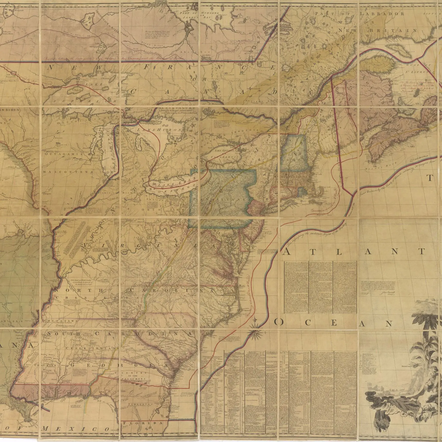
In 1897 B.F. Stevens annotated this 1775 map by copying all the colors and annotations from King George III’s map.

A National Archives Foundation educational resource using primary sources from the National Archives
View the full document here: https://docsteach.org/document/annotated-map-of-the-british-colonies-1775/
In 1897 B.F. Stevens annotated this 1775 map by copying all the colors and annotations from King George III’s map.
During the negotiations to end the Revolutionary War, all sides used a copy of the so-called Mitchell map. The red lines marked on the map were the agreed-upon boundaries between the United States, the remaining British colonies, and Spanish territories.
This primary source comes from the Records of Boundary and Claims Commissions and Arbitrations.
National Archives Identifier: 2450020
Full Citation: Carto Series 27; Annotated Map of the British Colonies in North America with the Roads, Distances, Limits and Extent of the Settlements; 1775; Maps and Related Records Pertaining to the Northeastern Boundary of the United States, 1796 – 1798; Records of Boundary and Claims Commissions and Arbitrations, Record Group 76; National Archives at College Park, College Park, MD. [Online Version, https://docsteach.org/document/annotated-map-of-the-british-colonies-1775/, February 20, 2026]
Rights: Public Domain, Free of Known Copyright Restrictions. Learn more on our privacy and legal page.

")
")