
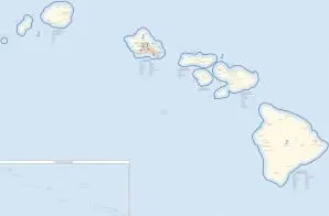
113th Congress of the United States, Hawaii State Map
- 2010
Share to Google Classroom
View the full document here: https://docsteach.org/document/113th-congress-of-the-united-states-hawaii-state-map/
Citation
This primary source comes from the Records of the Bureau of the Census.
National Archives Identifier: 124068991
Full Citation: 113th Congress of the United States, Hawaii State Map; 2010; [Decennial] Census of Population and Housing, 2010: Thematic Maps, Large Sheet Maps; Thematic Maps from the 23rd Census of Population and Housing, 2010 – 2010; Records of the Bureau of the Census, Record Group 29; National Archives at College Park, College Park, MD. [Online Version, https://docsteach.org/document/113th-congress-of-the-united-states-hawaii-state-map/, December 21, 2025]
Rights: Public Domain, Free of Known Copyright Restrictions. Learn more on our privacy and legal page.
Related Documents

Bush V. Gore Supreme Court Decision
Contemporary United States (1968 to the present)

Selections from the Hearings before the Subcommittee on Commerce and Finance about Toy Industry
Contemporary United States (1968 to the present)

Letter from Evelyn Buckley about Toy Easter Bunny
Contemporary United States (1968 to the present)
