Lewis & Clark’s Expedition to the Complex West
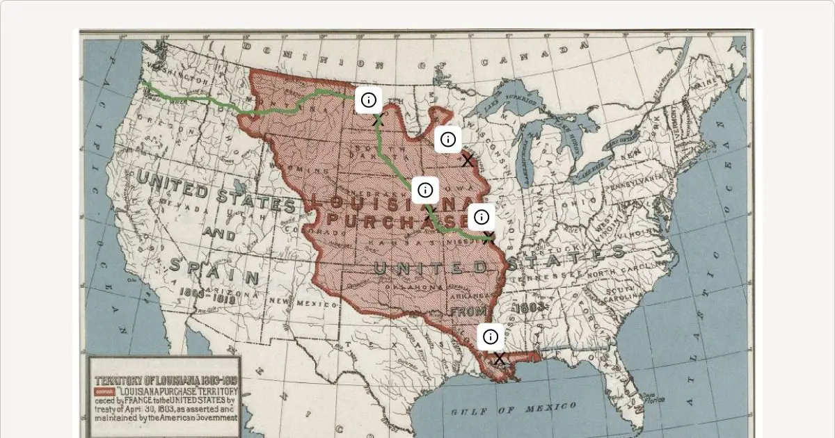
In 1803 the United States purchased the Louisiana Territory from France. President Jefferson sent co-captains Meriwether Lewis and William Clark to explore west of the Mississippi River in 1804. Their route west is shown in green. Although this territory was unknown to some, to others it was very familiar, and who owned the land is debated.
Examine the documents related to the Louisiana Purchase and the Lewis and Clark Expedition. Determine where different groups were involved and use the hints to place the documents on the X’s on the map.
Please Note: Activities may not be optimized on mobile devices. For the best experience, complete the activity on a desktop or laptop.
View the full activity: https://docsteach.org/activity/lewis-clarks-expedition-to-the-complex-west/