

[printfriendly current='yes']
Growth of the United States: Map of the Louisiana Purchase (Analyzing a Primary Source)

Analyzing Documents
Share to Google Classroom
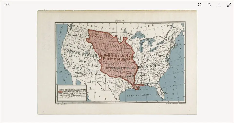
This map of the United States highlights in red the territory included in the Louisiana Purchase. Bought from France in 1803, the 820,000 square miles would eventually be split among the 16 states whose borders are outlined in black. The map was created for the centennial of the Louisiana Purchase in 1903.
Take a minute to examine the map, then answer the questions that follow.
Please Note: Activities may not be optimized on mobile devices. For the best experience, complete the activity on a desktop or laptop.
View the full activity: https://docsteach.org/activity/growth-of-the-united-states-map-of-the-louisiana-purchase-analyzing-a-primary-source/

To the extent possible under law, Lily Hofstetter has waived all copyright and related or neighboring rights to “Growth of the United States: Map of the Louisiana Purchase (Analyzing a Primary Source)”