[printfriendly current='yes']
Analyzing a Map with Data
Zoom/Crop
Share to Google Classroom
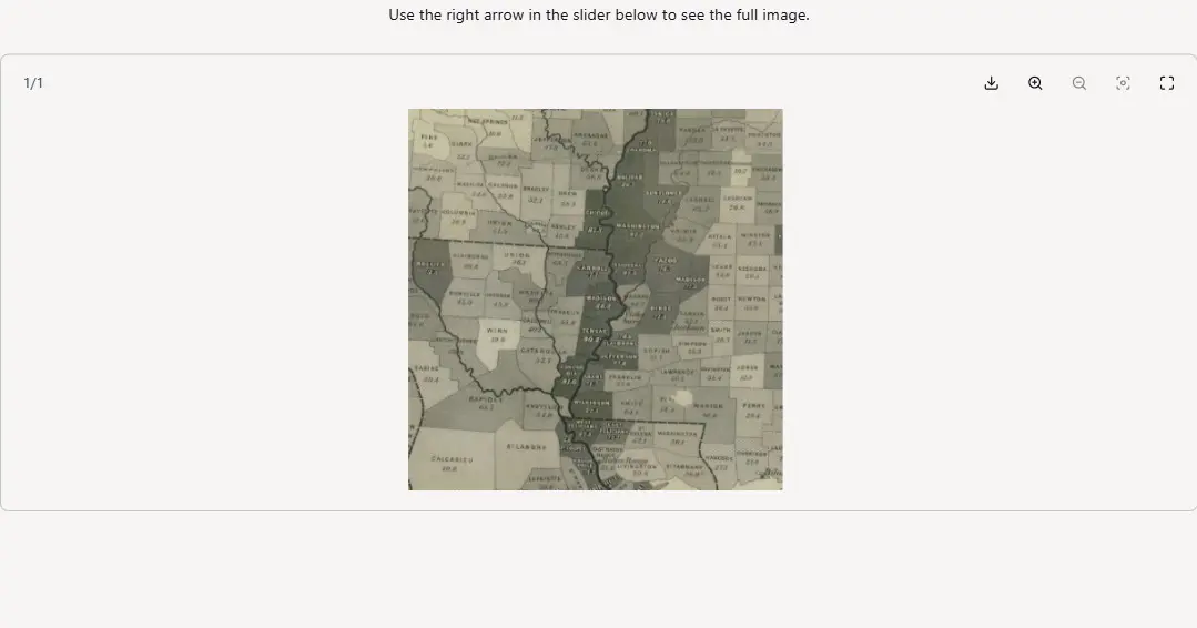
Look at the historical map below. You are seeing only a small portion of this map to start with.
- What do you see?
- What do you think it is about?
- What place or places are shown?
- What do you think the words represent?
- What do you think the numbers represent?
- What do you notice about the changing shades of gray? How does it relate to the numbers?
Once you’ve answered these questions, click on the other thumbnail to see more of the map.
Please Note: Activities may not be optimized on mobile devices. For the best experience, complete the activity on a desktop or laptop.
Use the right arrow above to see the full image.
View the full activity: https://docsteach.org/activity/analyzing-a-map-with-data/
You now see a larger portion of a historical map.
- What do you see now?
- What place or places are shown?
- What do you think it is the purpose of this map?
To the extent possible under law, National Archives Foundation has waived all copyright and related or neighboring rights to “Analyzing a Map with Data”