Comparing Congressional Districts in Georgia and North Carolina
Focusing on Details: Compare and Contrast
All documents and text associated with this activity are printed below, followed by a worksheet for student responses.Introduction
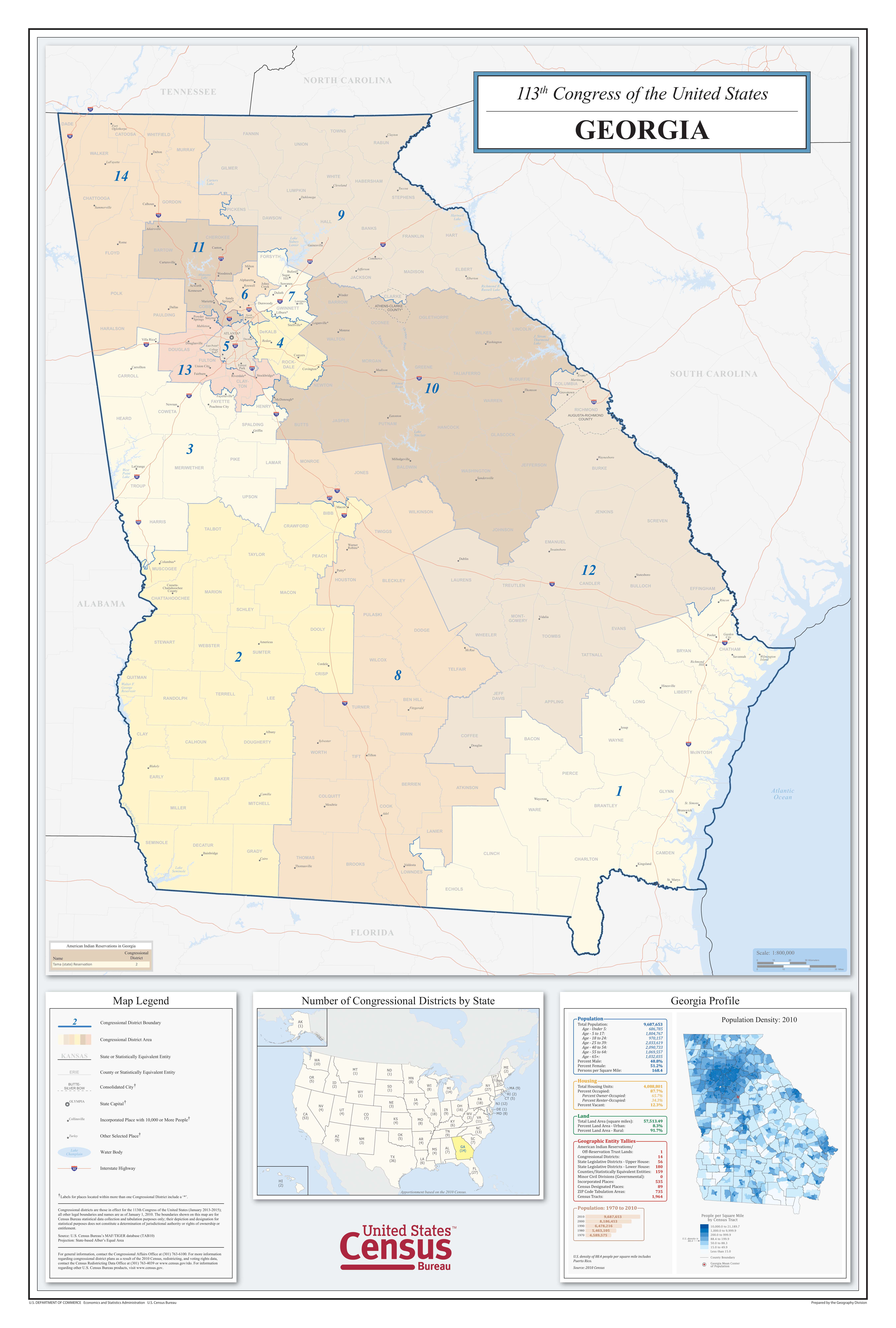
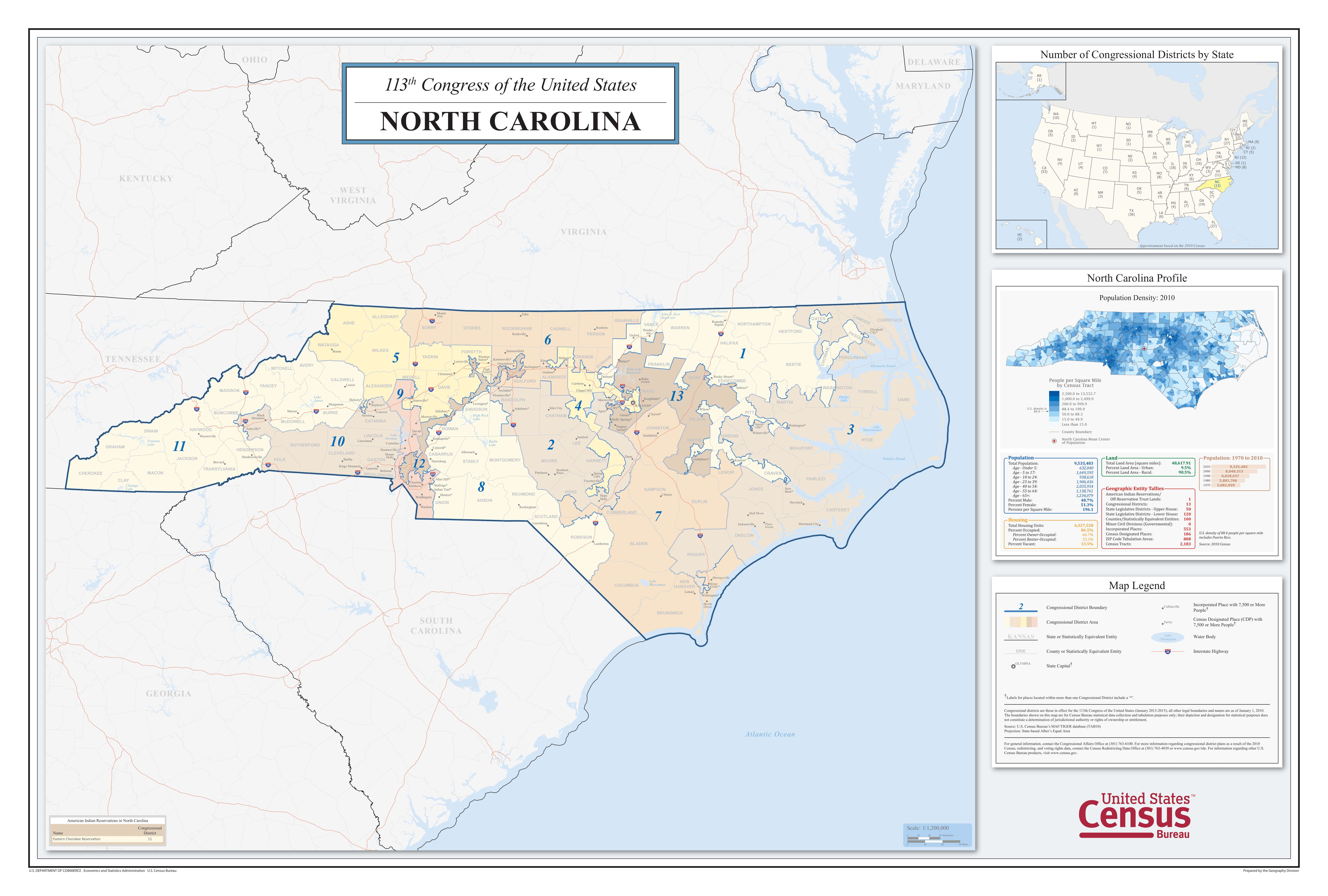
Georgia and North Carolina share a lot in common. Besides sharing a nearly 70 mile border, North Carolina and Georgia have a similar population and a similar area in square miles. And, following the 2010 Census, they also had a similar number of representatives in Congress (13 and 14 representatives respectively). One major difference, however, is how those Congressional districts were drawn following the 2010 Census.Compare and contrast the Congressional Districts of Georgia and North Carolina. What are the major similarities and differences?
Name:
Class:
Class:
Worksheet
Comparing Congressional Districts in Georgia and North Carolina
Focusing on Details: Compare and Contrast
Examine the documents included in this activity and write your response in the space provided.

Your Response
1
Activity Element
113th Congress of the United States, North Carolina State Map
2
Activity Element
113th Congress of the United States, Georgia State Map
Conclusion
Comparing Congressional Districts in Georgia and North Carolina
Focusing on Details: Compare and Contrast
- How do you think Congressional districts should be drawn?
- Which state do you think created more appropriate Congressional districts? Why?
Your Response
Document
113th Congress of the United States, North Carolina State Map
2010
This primary source comes from the Records of the Bureau of the Census.
National Archives Identifier: 124069369
Full Citation: 113th Congress of the United States, North Carolina State Map; 2010; [Decennial] Census of Population and Housing, 2010: Thematic Maps, Large Sheet Maps; Thematic Maps from the 23rd Census of Population and Housing, 2010 - 2010; Records of the Bureau of the Census, ; National Archives at College Park, College Park, MD. [Online Version, https://docsteach.org/documents/document/113th-congress-of-the-united-states-north-carolina-state-map, April 18, 2024]113th Congress of the United States, North Carolina State Map
Page 1
Document
113th Congress of the United States, Georgia State Map
2010
This primary source comes from the Records of the Bureau of the Census.
National Archives Identifier: 124068985
Full Citation: 113th Congress of the United States, Georgia State Map; 2010; [Decennial] Census of Population and Housing, 2010: Thematic Maps, Large Sheet Maps; Thematic Maps from the 23rd Census of Population and Housing, 2010 - 2010; Records of the Bureau of the Census, ; National Archives at College Park, College Park, MD. [Online Version, https://docsteach.org/documents/document/113th-congress-of-the-united-states-georgia-state-map, April 18, 2024]113th Congress of the United States, Georgia State Map
Page 1