Map of the Louisiana Purchase Territory
1903
Add to Favorites:
Add all page(s) of this document to activity:
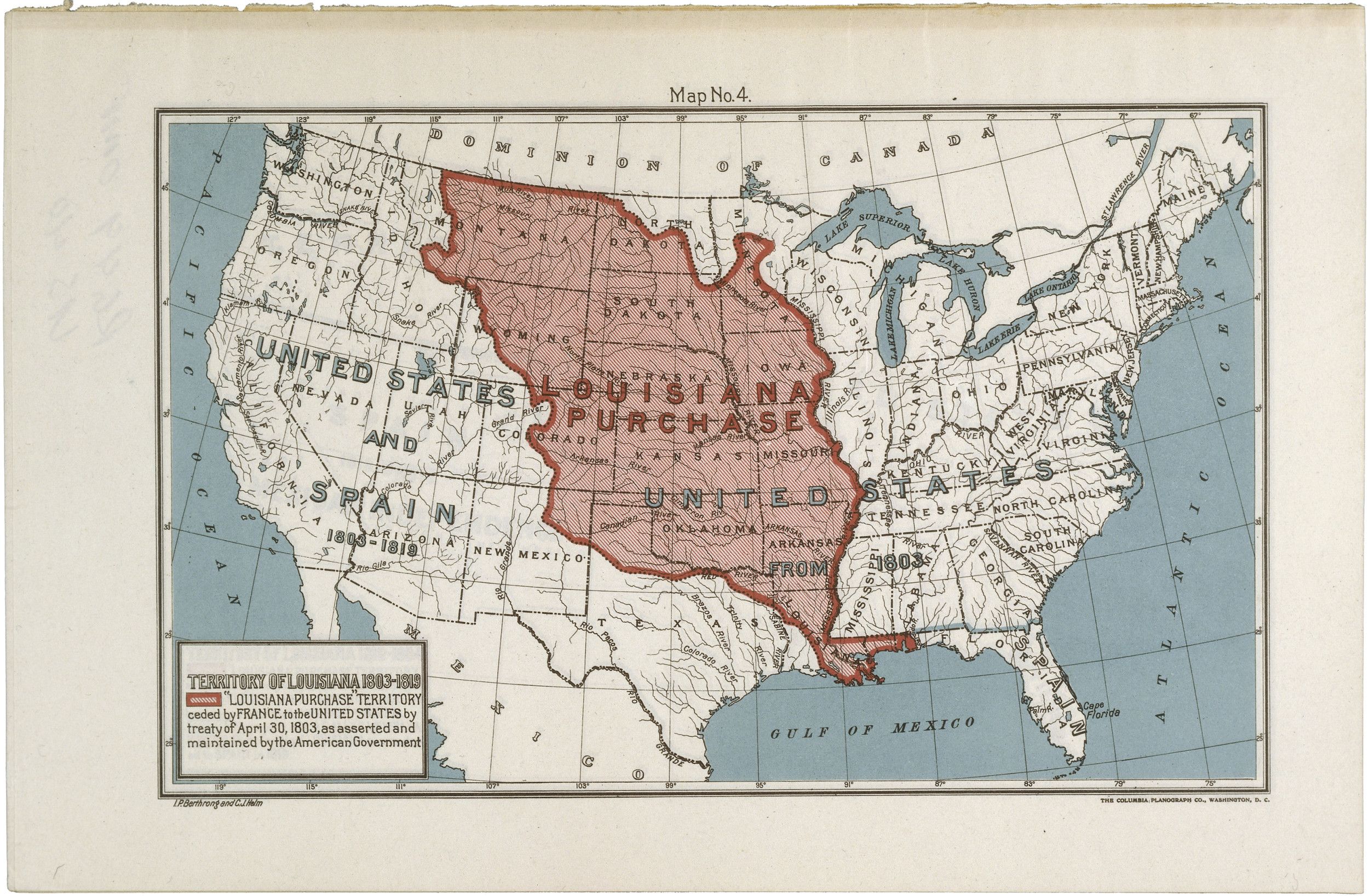
This map of the United States highlights in red the territory included in the Louisiana Purchase. Bought from France in 1803, the 820,000 square miles would eventually be split among the 16 states whose borders are outlined in black. The map was created for the centennial of the Louisiana Purchase in 1903.
This primary source comes from the Records of the Bureau of Land Management.
National Archives Identifier: 594889
Full Citation: Map RG49-OMF-US40-4; Map of the Louisiana Purchase Territory; 1903; United States; Old Map File Manuscript and Annotated Maps of the United States and Its Territories, 1812 - 1946; Records of the Bureau of Land Management, Record Group 49; National Archives at College Park, College Park, MD. [Online Version, https://docsteach.org/documents/document/map-louisiana-purchase, April 19, 2024]Activities that use this document
- Analyzing a Map of the Louisiana Purchase
Created by the National Archives Education Team - Lewis & Clark's Expedition to the Complex West
Created by the National Archives Education Team
Rights: Public Domain, Free of Known Copyright Restrictions. Learn more on our privacy and legal page.
