Map of the United States of America with the British Possessions and Spanish Territories
ca. 1800
Add to Favorites:
Add all page(s) of this document to activity:
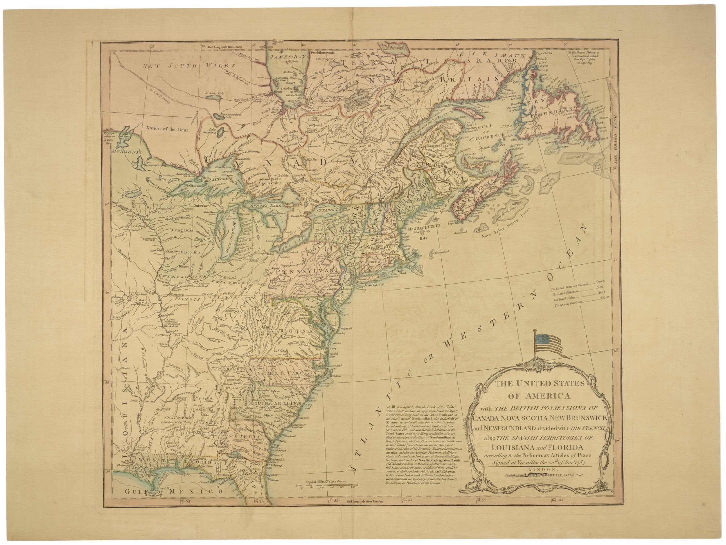
At the end of the Revolutionary War and in the wake of the Treaty of Paris, new maps were produced to reflect the new North American landscape. Clearly marked lines defined the boundaries of the United States.
The full title of this map is: Map of the United States of America with the British Possessions of Canada, Nova Scotia, New Brunswick and Newfoundland Divided with the French, also the Spanish Territories of Louisiana and Florida According to the Preliminary Articles of Peace Signed at Versailles the 20th of January 1783
The full title of this map is: Map of the United States of America with the British Possessions of Canada, Nova Scotia, New Brunswick and Newfoundland Divided with the French, also the Spanish Territories of Louisiana and Florida According to the Preliminary Articles of Peace Signed at Versailles the 20th of January 1783
This primary source comes from the Records of Boundary and Claims Commissions and Arbitrations.
National Archives Identifier: 2450016
Full Citation: Carto Series 8, Map No. 19; Map of the United States of America with the British Possessions and Spanish Territories; ca. 1800; Maps Related to the Northeastern Boundary of the United States, 1827 - 1828; Records of Boundary and Claims Commissions and Arbitrations, Record Group 76; National Archives at College Park, College Park, MD. [Online Version, https://docsteach.org/documents/document/map-us-british, April 25, 2024]Rights: Public Domain, Free of Known Copyright Restrictions. Learn more on our privacy and legal page.
